West Lombok, Geospatial News - Tsunamis, earthquakes, landslides, forest fires, volcanic eruptions, floods, and liquefaction occurring in Indonesia, have made this country known as a disaster laboratory. Therefore, mapping of potential disasters in Indonesia is very important as part of disaster mitigation efforts.
House of Representatives Commission VII member Kurtubi explained, the long-term program in Lombok is to build ports, power plants and oil refineries. All of them are planned using Geospatial Information (IG).
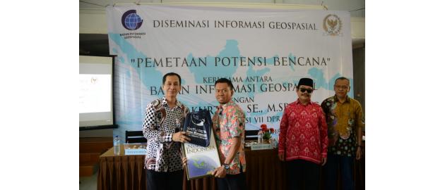
"However, this program was stopped because of a large earthquake with a strength of 7 on the Richter Scale that rocked Lombok some time ago. That's when we realized, we needed a mapping of potential disasters so that development programs were not hampered or stopped because of disasters. This is the role of BIG in charge of providing maps related to potential disasters, "he explained while giving a speech at the IG Information Dissemination event in the Hall of Lingsar District, West Lombok, West Nusa Tenggara NTB, Saturday, February 2, 2019.
BIG Inspector Sugeng Prijadi added, BIG was indeed tasked with making maps in Indonesia, especially base maps. This basic map is used by other agencies to make thematic maps as needed.
"Mapping a potential disaster is how to use the IG to find out where the areas that are potentially affected by the disaster. BIG made its basic map, other ministries, for example the Ministry of Public Works and Public Housing (PUPR), made further use of the map, "explained Sugeng.
Assistant III in the Government of West Lombok Regency H. Faturrahim as the host, admitted that the successive earthquake that occurred at the end of July and continued until August 2018 had destroyed many things. Disasters forced Lombok to clean up.
"This country is a disaster supermarket. This must all be mapped to anticipate the coming disaster. In West Lombok, there are 72 thousand people affected by the earthquake in July to August 2018, "he said.
At the core event, BIG Aris Haryanto, Head of Institutional and Geospatial Information Network Nodes explained about 'Geospatial Information in Disaster Mitigation'. According to him, disaster response mapping must be done immediately to identify the impact caused and the recovery plan.
"On August 1-5 2018, BIG sent a Rapid Reaction Unit (SRC) to Lombok to make an assessment of damage, losses and post-disaster needs. Assessment of post-disaster needs can be an instrument for the government and stakeholders in developing policies, programs, rehabilitation activities, and reconstruction with accurate information, "he said.
Closing the event, the Head of the Center for Standardization and Institutional Geospatial Information Suparajaka said that Kurtubi had ideas about energy management for a better life in Lombok by utilizing IG. He also thanked all parties who had participated in IG dissemination. (ATM / NIN).